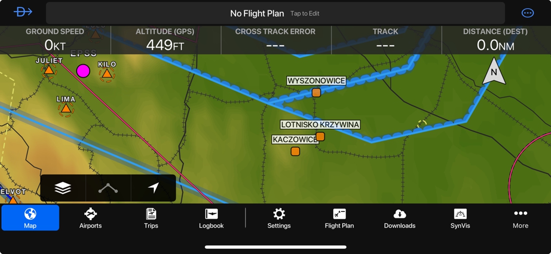
Polish Aviation Navigation Database Upgrade - 02.2026
These data are supplied as an unofficial reference. While every effort is made to keep the file accurate and current, it must not be treated as an authoritative source. Before planning or conducting any flight, consult the latest AIP, NOTAMs, and other official publications, and obtain up-to-date information directly from the aerodrome operator. Pilots remain responsible for maintaining situational awareness in the circuit, as traffic in the vicinity may not adhere to the published pattern or recommended routes.
Dynon SkyView
The Polish Navigation Database Upgrade for the Dynon SkyView HDX and Dynon SkyView Touch includes airfields and heliports not found in the default database. Files should be imported into the HDX/Touch system as User Waypoints, which will save the data in your system. The update includes:
- 100+ airfields - up-to-date data obtained from airfield owners and other reliable sources. Additional information is added in the Remarks section. Airports with runways shorter than 400m are marked as Ultralight.
- 300+ heliports - some private but mostly medical (LPR)
To install, choose either airports, heliports, or both:
- Download the ZIP with CSV files
- Load new files onto your Skyview USB stick
- Import data into SkyView as User Waypoints. If updating from an older version, remove it first (Menu → User Waypoints → Clear Database)
Garmin G3X
The Polish Navigation Database Upgrade for the Garmin G3X includes airfields and heliports. Files should be imported into the G3X system as Flightplans, which will save the data in your system. The update includes:
- 100+ airfields - up-to-date locations, shown as user waypoints
- 300+ heliports - some private but mostly medical (LPR)
To install, choose either airports, heliports, or both:
- Download the ZIP with FPL files
- Load the files onto your G3X's SD card
- Import the FPL file as you would import a flight plan. Clear the User Waypoints list first.
Garmin Pilot App
The Polish Navigation Database Upgrade for the Garmin Pilot App includes airfields and heliports. The update includes:
- 100+ airfields - up-to-date locations, shown as user waypoints
- 300+ heliports - some private but mostly medical (LPR)
To install, choose either airports, heliports, or both, then use one of these methods:
- E-mail the updated file to your iPad/iPhone as an attachment, then open it and use the share/action menu to select Copy to Pilot.
- AirDrop the updated file from your Mac to your iPad/iPhone, press Accept, and select Pilot.
 Download Polish Navigation Database Upgrade for Garmin Pilot App
SkyDemon
The Polish Navigation Database Upgrade for SkyDemon consists of data missing from the default database, specifically:
- 100+ airfields - up-to-date data obtained from airfield owners and other sources. Data includes field elevation, runways, taxiways and aprons, buildings, water bodies, nearby powerlines, and contact information. Remarks are added in the Approach Information section. Airfields with runways shorter than 400m are marked as Microlight.
- 300+ heliports - some private but mostly medical (LPR)
- All DOLs (Drogowy Odcinek Lotniskowy - Road Airfield Strips) - possible emergency landing locations
- Non-standard traffic patterns as green custom routes with altitude information
- Obstacles such as powerlines and antennas in airfield vicinity (powerlines are drawn as blue helicopter routes)
- Restricted zones over cities and towns, as per airport manuals
- City Administrative Boundaries for cities >25.000 population, shown as simplified Restricted areas
PC / PC → Mobile Device
To install:
- Download and run the installer (disabling antivirus might be required). This completes the PC installation.
- To transfer the data to your mobile device, on the desktop SkyDemon select Setup → Custom Data → Save to Cloud
- On your mobile device select Setup → Cloud → Load Custom Data from Cloud
Mac → iPhone / iPad
To install:
- Preparing the folder
- Launch the Finder
- Create a folder named CustomData anywhere on your computer
- Download the files using the download link, unpack it and upload all the files into that CustomData folder
- Uploading to SkyDemon
- Connect your iPhone/iPad via cable
- Launch iTunes (or Finder on newer macOS versions)
- Select your iPhone/iPad and go to the Apps section
- At the bottom of the page, select the file sharing table
- Click on SkyDemon
- Drag and drop the CustomData directory from your computer into the SkyDemon app's file window (such a folder might already be there)
- In the popup window (if it appears), confirm overwriting the directory
- Restart SkyDemon, and the data should appear.